2.1 Origin and Composition
Convection cells must have developed in the Earth’s Mantle at a very early stage, consequently initiating the differentiation of the elements composing the original magma. Just like foam in a boiling pot, the less dense elements accumulated at the top of the up flow side of the convection cells, concentrating at the surface and consolidating into a “crust”, thus creating the continents.
These lighter rocks, silicon rich, are classified as oversaturated (acid), and contain an abundance of quartz. They encompass the granite family, and its volcanic equivalent is termed rhyolite. Of the remaining magma, the most common member and the one which forms the ocean floors, does not have enough silicon for quartz to form, is classified as saturated, and its most common rock family is the gabbro, with its lavas termed basalt. The rocks with least silicon content are classified as undersaturated (alkaline), and one of its rock types is peridotite.
It is easy to understand that along crustal plate diverging boundaries, numerous cracks will form through which the fluid magma from the mantle will be injected. Hence, igneous rocks associated with diverging boundaries, if within an ocean, will have a basaltic composition and form a ridge along the fissures separating the plates. Naturally, all the portions of the fissure’s ridge emerging above the ocean surface form islands, and the best known of these oceanic ridges is the one at the centre of the Atlantic. Also, this is the reason why, with very few exceptions, most of the existing islands are constituted by basaltic rocks like the Azores archipelago, and they are termed Oceanic Islands (fig. 1).
There are some exceptions like the Seychelles islands, which have a granitic composition because they actually represent a remanent that stayed behind when the Indian, Australian and African plates parted ways. In fact Madagascar must also be included, either as a micro continent or an oversized island. Such islands are termed Continental Islands.
If, on the other hand, the plate divergence is within a breaking continent like the Rift Valley in Africa, the igneous rocks will be basaltic, but only if the magma being tapped is from the mantle.
At converging boundaries, where the rock masses are under compression, it is not so straight forward because:
- When converging plates have identical densities (continents), the collision, obduction, will cause the formation of mountains, like the Himalayas, formed by the impact of the Indian and the Asia plates.
- Or, if one of the plates is heavier, it will be subducted under the other one, forming a trench like the one along the Asian western margin with its associated volcanic ring.
So, for converging plates, I think that in the majority of cases, the igneous rocks originate from the melting of the local rocks due to the incredibly high temperatures and pressures caused by the friction developed during compression. Thus, their composition will differ according to their relative location, with basic rocks for the sector close to the subduction trench, because they may be fed by oceanic floor rocks. Within the continental masses, acidic rocks will predominate.
2.2 Type of Occurrence
2.2.1 Volcanic Rocks
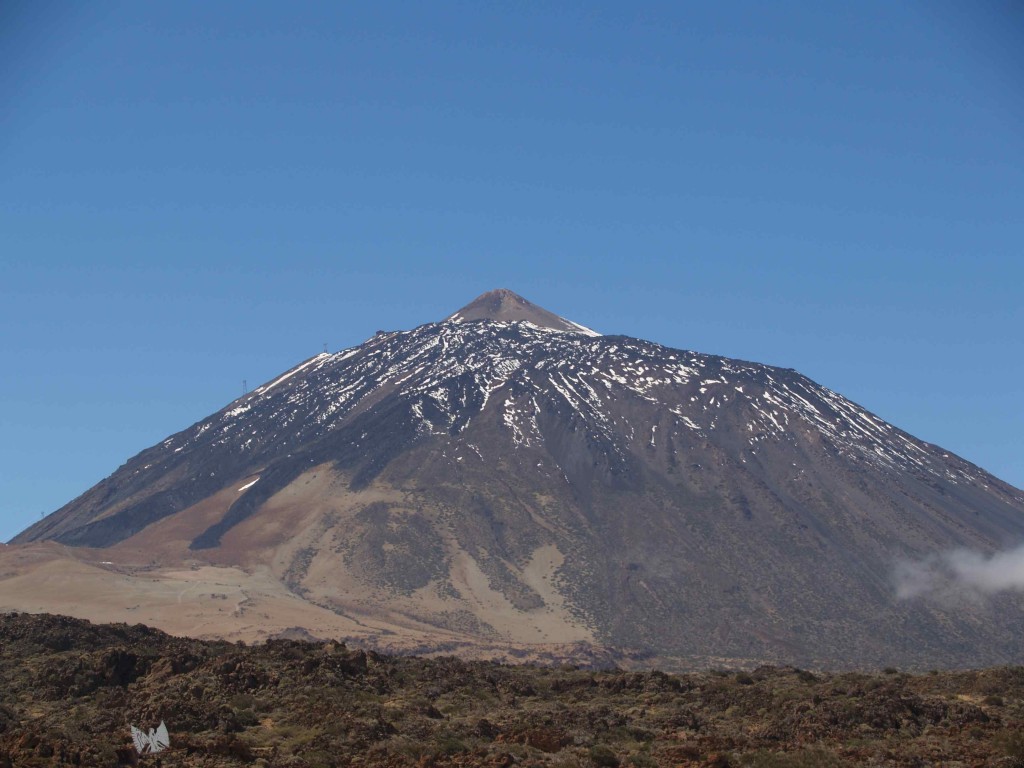
Molten magma is continuously being spewed from the mantle through all sorts of existing fractures. If ejected into the atmosphere, it is known as lava, with the resulting rocks termed volcanic. The ducts through which the lava pours have predominantly a pipe like form and, as the magma cools it creates the well known volcano conic shapes (fig. 1B). Further, because the surrounding atmospheric temperature is markedly lower, the lava will cool very rapidly and the resulting rock will tend to be fine grained
Also, volcanic activity tends to be periodic and, if the time between separate phases is long enough, the original magma will have solidified, forcing new craters to develop during successive new stages, thus frequently causing de development of a maze of craters of different ages (fig. 2).
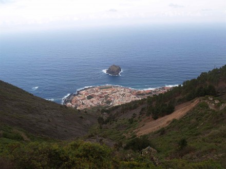
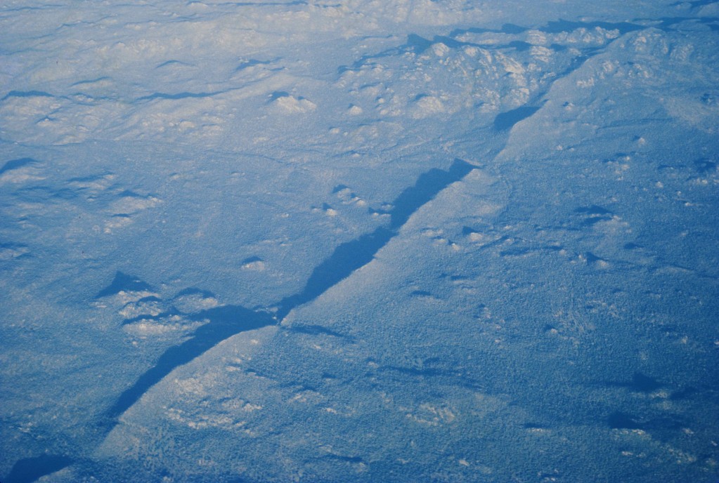
The volcanic exhalations may be gentle and fairly continuous, taking the form of a very fluid mass termed lava flows, which will spread down the volcanic cone and form a fan at the base. In the example shown on figure 3 from Tenerife, the fan actually entered into the sea, and that is where the town of Garuchio was built.
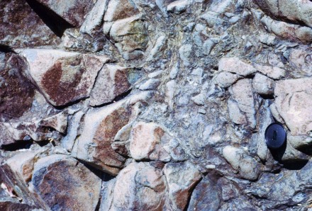
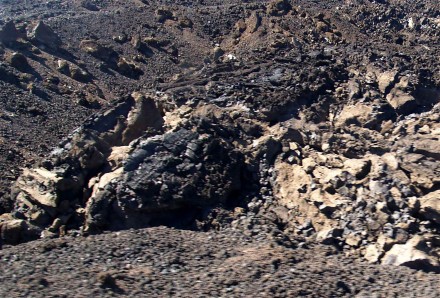
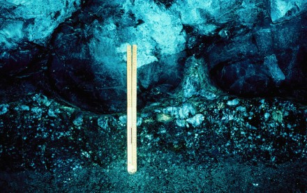
If, on the other hand, the magma has a high gas content, more violent outpours will occur in the form of ash, termed pyroclastic, with small fragments predominating. In the example shown in figure 4 there is a gentle lava flow capping such a pyroclastic explosive outburst, with the larger clasts being easily identified because of their much darker colour, and this is possibly because they represent fragments of already consolidated lava only spewed out of the pipe at this stage.
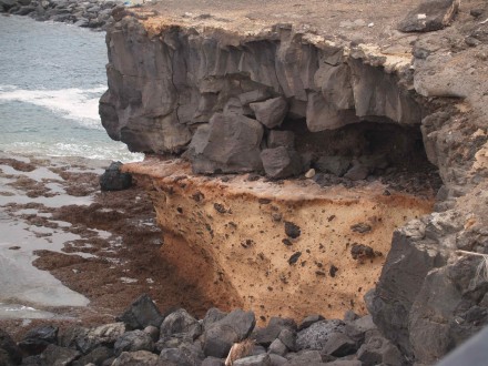
Figure 4 – Layer of volcanic ash (pyroclasts) overlain by basalt (view approximately 6 m high) (Tenerife, Canarias Archipelago).
These pyroclastic explosive bursts are due to the high gas content of the magma, as well as the stage of consolidation of the lava being spewed out. In extreme cases we will have volcanic breccias (fig. 4B).
The appearance of the consolidated lava will also be affected by:
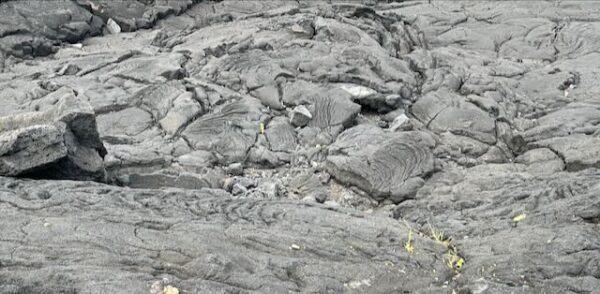
• its degree of plasticity, which, when very high gives a very contorted appearance (fig. 5);
• the rate of cooling which, when very rapid, yields volcanic glass, termed obsidian (fig. 6);
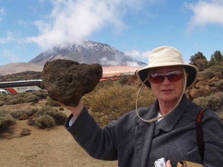
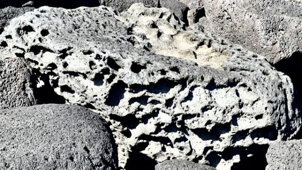
• high fluidity as well as gaseous content, will cause the lava to be very porous, pumice stone, and the porosity will make these rocks very light (fig. 7).
- Or, if the lava is very viscous, the gaseous content will not be so evenly distributed but rater form lager bubbles within the lava (fig. 7B).
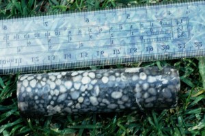
- The porosity will allow water to flow through the hollows and, with time, the substances under solution will precipitate filling them, and giving rise to what is known, as amygdaloidal lava (fig. 8).
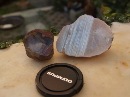
- When the size of those hollows is sufficiently large we have the formation of the famous agates and geodes (fig. 9), which will tend to broadly have a spherical form but may reach quite a considerable size and present a huge variety of internal shapes. The term agate is used when the precipitate is not crystalline, and geode when it is.
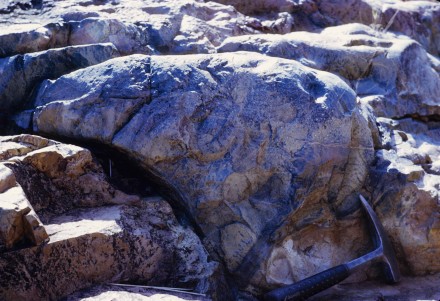
• Lava that flows into the sea freezes as it tumbles in and forms very characteristic spherical shapes, termed pillows. As these pillows fall on top of those already settled, if the lava is still sufficiently plastic, its lower portion will become sort of squeezed between the ones more solid below (fig. 10).
If, on the other hand the pillows fall on soft ground, their spherical shapes are preserved as they squeeze the soil below (fig. 11).
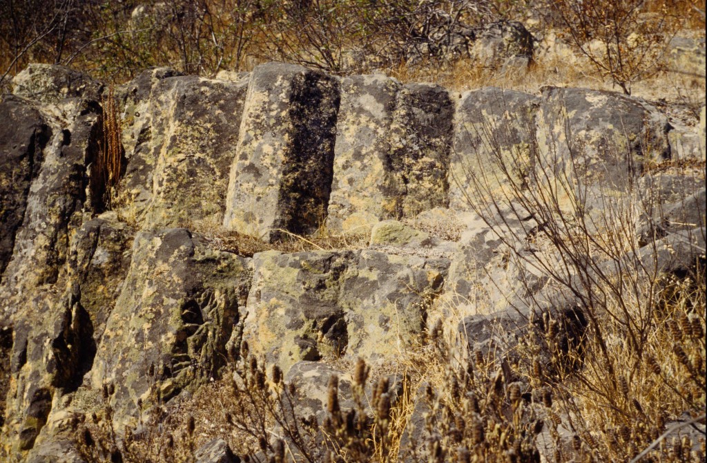
• Lava cooling on land often develops a very characteristic hexagonal jointing, columnar. This occurs both with basalt (fig. 12).
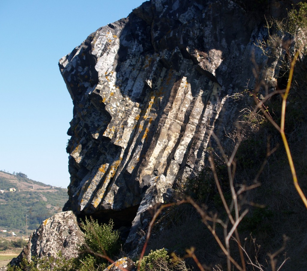
Figure 12 – Volcanic plug basalt showing columnar jointing (view approximately 6 m high) (Mafra region, Portugal).
as well as rhyolite (fig. 13).
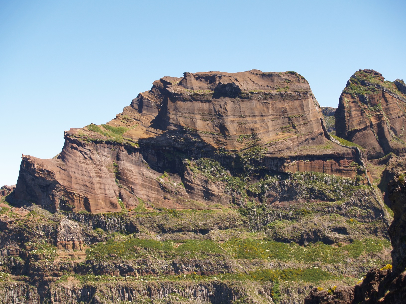
Because volcanos produce a variety of materials, from lavas to pyroclasts, their settling characteristics give rise to rock assemblages considerably similar to those of sedimentary rocks (Item 6), as nicely exemplified by the rock assemblage at Pico do Arieiro in Madeira. As can be seen (fig. 13B), there are horizontal lava layers with distinct columnar jointing and above those we have a thick succession of “cross bedded” pyroclastic horizons.
Within this upper assortment there are beds that range from poorly sorted (fig. 13C),
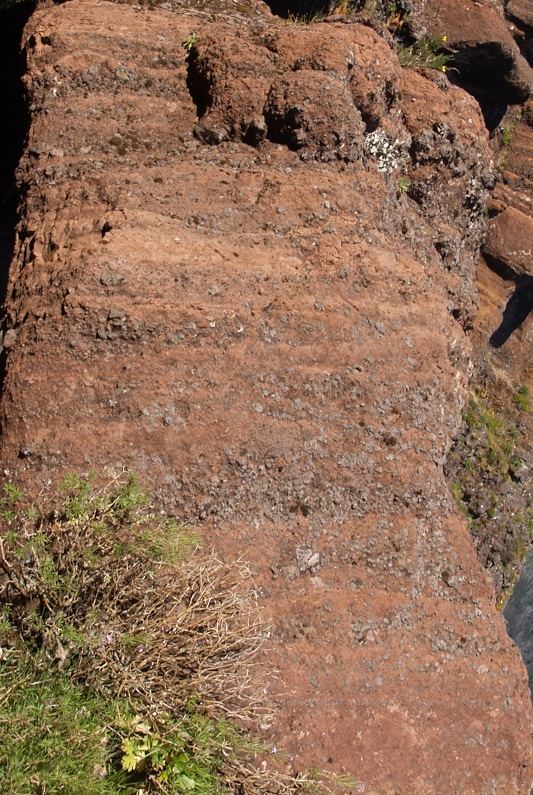
Figure 13C – Column of poorly sorted pyroclasts (hight approximately 2.5m) (Pico do Arieiro, Madeira).
to moderately well sorted but rather coarse grained (fig. 13D).
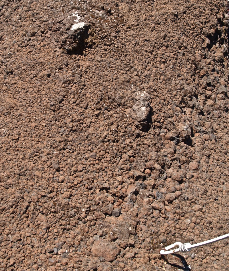
Figure 13D – Assemblage of rather coarse pyroclasts (width of picture, approximately 30 cm) (Pico do Arieiro, Madeira).
Finally, at the ending stage of the volcanic activity when the lava deep within the crater is still very hot the phreatic water in contact with that material reaches high temperatures and is expelled into the atmosphere as geysers or fumaroles, often with the water dissolving some of the lava substances, of which the most noticeable is sulphur (Fig. 13E).
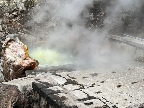
Figure 13E – A fumarole with boiling yellowish water, and showing a thick coating of sulphur covering the rock on the left hand side (S. Miguel Island, Azores).
2.2.2. Hypabyssal Rocks
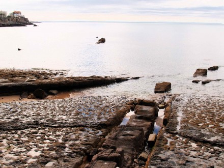
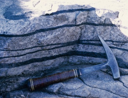
A significant proportion of the magma flowing through the tension cracks will actually consolidate along them. The resulting rocks are termed hypabyssal, that is, intermediate between plutonic and volcanic. The majority of the ducts through which magma flows are relatively narrow. As such, the magmas filling these fissures will cool quite fast and the resulting rocks will be predominantly fine to medium grained. If these intrusives are parallel to the surrounding strata they are termed sills (fig. 13E).
When cutting across, they are named dykes which, as shown in figure 14, can be very long.
Also, these fissures are a consequence of the breaking away of continental plates, and fracturing of non homogenous brittle materials usually have associated splitting, termed conjugate faulting. Thus dykes tend to occur in conjugate sets (fig. 15).
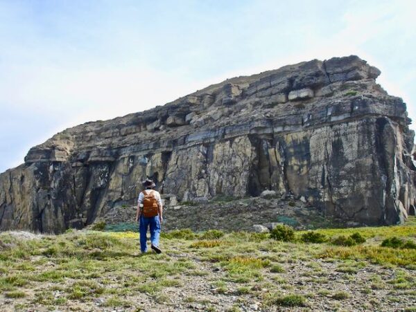
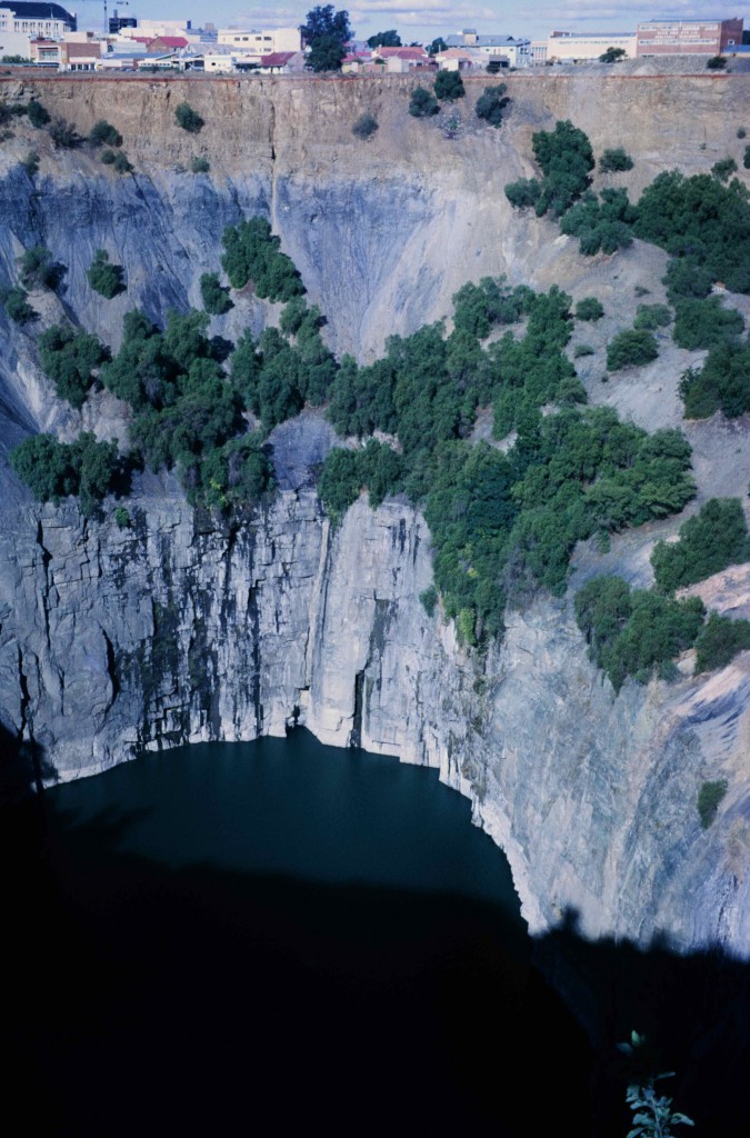
Hypabyssal rocks occasionally have pipe like forms, many of them corresponding to the volcanos, and they may have considerably large diameters. For those that did not actually reach the surface, their magma will take longer to cool, thus becoming more coarse grained. When they occur along rifting lines and their magma source is very deep, that is from the mantle, it may have an undersaturated composition like the kimberlites (fig. 16),
or they may already show a considerable level of differentiation like the carbonatites (fig. 17).
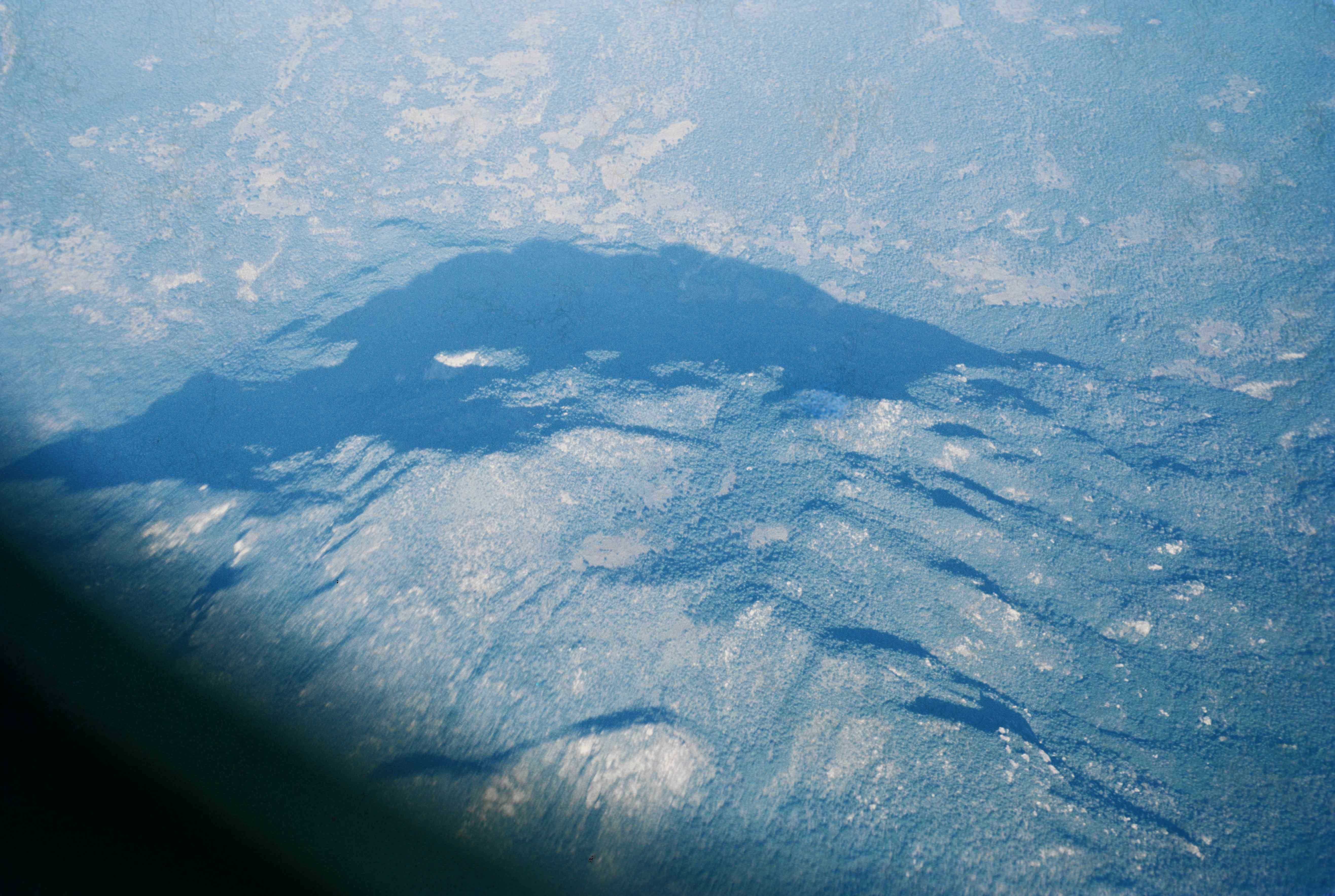
Figure 17 – Aerial view of a large carbonatite plug outcrop on a peneplane (Central Angolan Plateau).
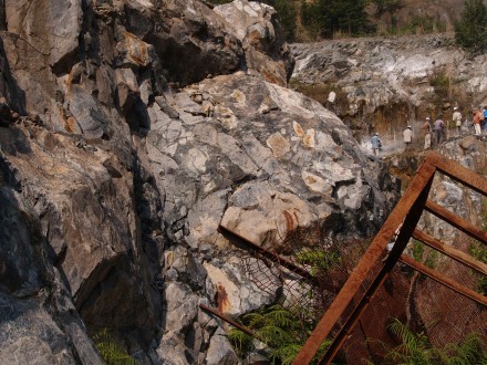
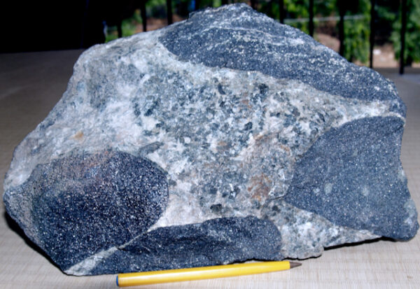
Volcanic breccias are moderately frequent (fig. 4B), but I think the Boula Igneous Complex in India is a rather unique example (fig. 18)
In fact I put it here rather than with the volcanic rocks, because, according to Augé and Thierry, this breccia was caused by a violent explosion within the magma ducts with the fragments belonging to the intruded, rather than the intruding rock and it must have happened at a considerable depth since the intruding basalt is very coarse grained, often pegmatitic (fig. 18A).
However the brecciated wall-rock shows very little movement. For example, the position of the very large chromite fragment shown in figure 19, is very close to its initial position relative to sector of the chromite lens unaffected by the explosive burst.
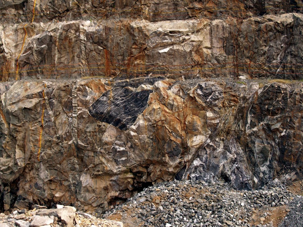
Figure 19 – Igneous breccia containing chromite clasts (view approximately 16 m high) (Boula, Orissa, India).
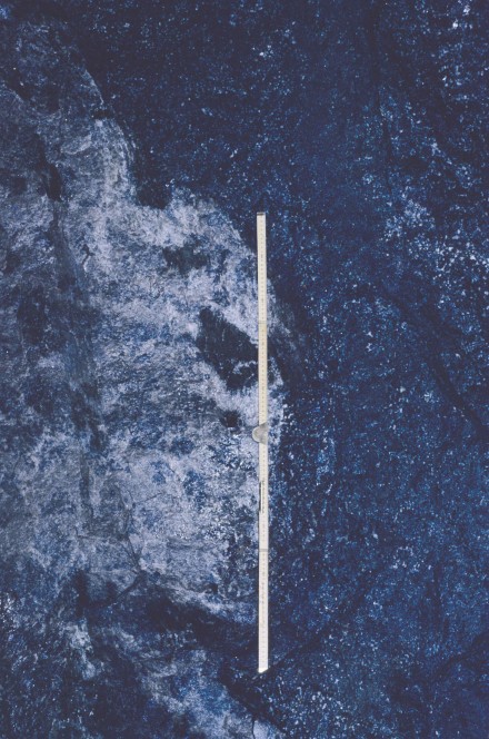
Other than the in situ shattering, what we had was the rotation of the fragments within a very hot chamber which partially melted the wall-rock (fig. 20).
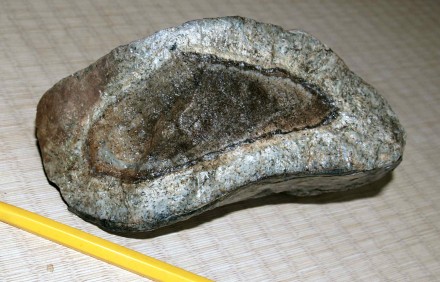
Figure 20 – Metasomatised igneous breccia fragment showing roundness and concentric reaction rim due to partial melting (Boula, Orissa, India).
2.2.3 Plutonic Rocks
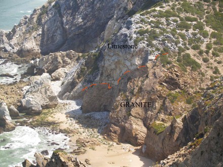
Plutonic rocks are formed by magmatic intrusions at great depths. Since we are dealing with a fluid intrusion, the contacts with the surrounding rocks tend to be irregular (fig. 21).
Further, even though these intrusions occur at great depths, the host rocks are still rather brittle and the magma intrudes through bedding planes and joints, forming a maze of dikes and sills across the host rock in the immediate vicinity of the pluton (fig. 21B).
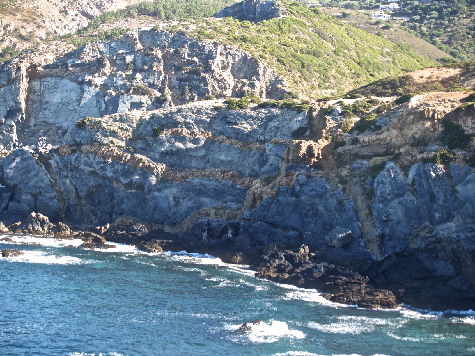
Figure 21B – Maze of granitic dykes and sills cutting the limestones surrounding the Sintra Granite (escarpment hight, about 20 m) (Sintra Mountain, Portugal)
The other consequence of these intrusions taking place at great depths and the fact that they generally have very large volumes is that, with the exception of the marginal areas of contact, this magma has a very long time to cool, allowing the development of coarse grained rocks. Often, since some of the substances crystallise more easily than others, they grow proportionally lager, like feldspar crystals in granite. In such cases they have a porphyritic texture (fig. 21C).
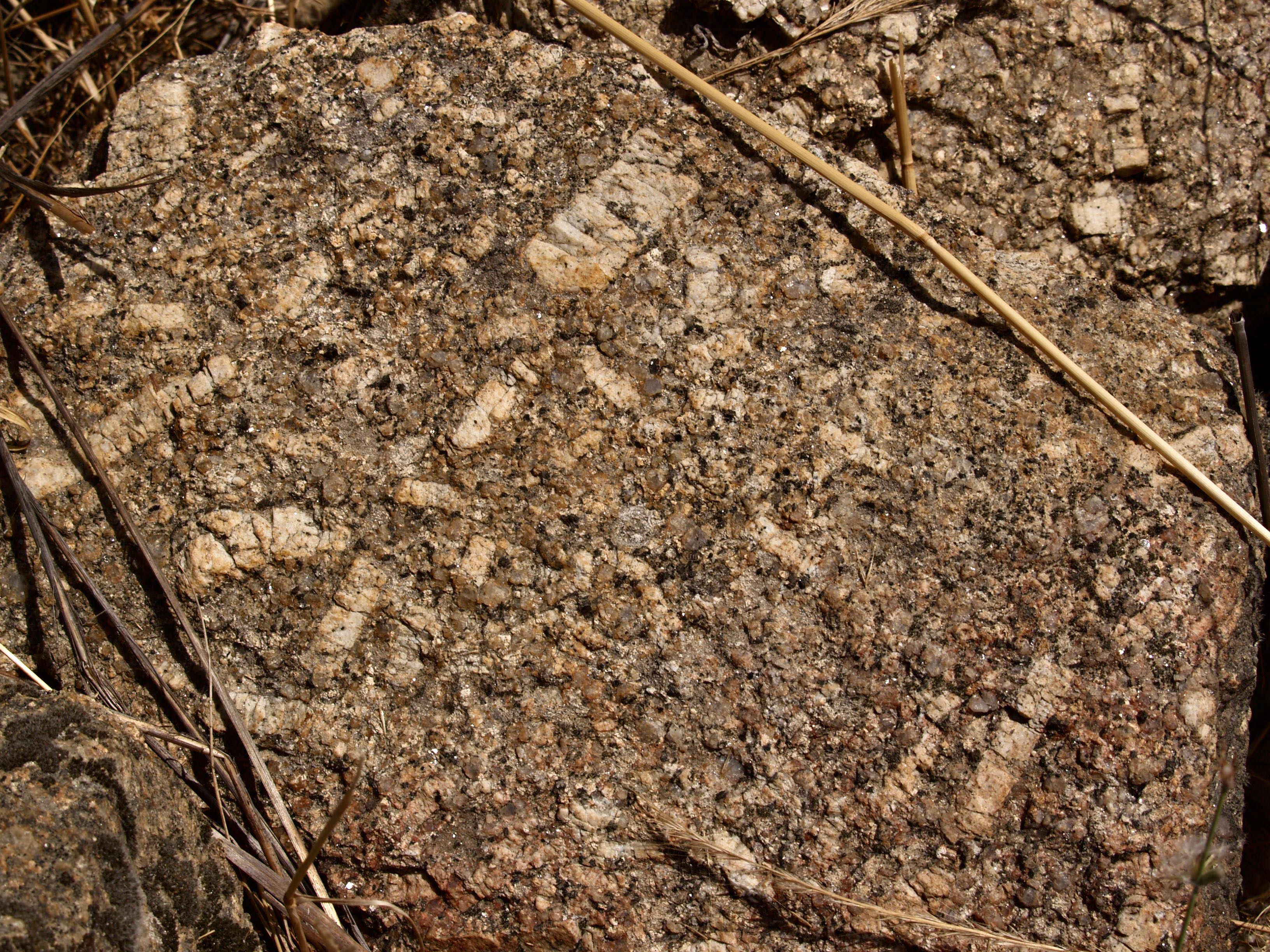
Figure 21C – A porphyritic granite where the much larger feldspar crystal resemble horse teeth (Belmonte, Portugal).
Or, when the magma is rich in volatiles it often has associated hydrothermal pegmatitic (ultra coarse grained) veins, giving rise to magnificently well developed crystals (fig. 22).
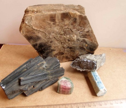
Figure 22 – Pegmatitic minerals: book of muscovite (back) (Perth, Canada); black tourmaline, red and green tourmaline and blue beryl (front) (Ligonha, Mozambique); Wolframite (Panasqueira, Portugal)
Of these pegmatitic crystals, perhaps the most impressive example I have ever come across, are those in the Naica caves in Chihuahua, Mexico. There, as stated by Wikipedia, the enormous selenite crystals originate from the hydrothermal fluids injected from the magma chamber below, into the surrounding limestone sediments. The figure I show, 22B, is not mine, I grabbed it from the Guardian Newspaper but, it is so spectacular that I felt I should add it here.
2.3 Magmatic Differentiation
Magmatic differentiation was already mentioned (item 2.1), but here I want to refer to two rather unique examples, the Boula Igneous Complex in India and the Bushveld Igneous Complex (BIC) in South Africa. Both these igneous lopoliths have a basic to ultrabasic composition, meaning that the intruding magmas had already had a significant amount of chemical differentiation from the initial mantle magma.
2.3.1 Differential Crystal Settling
Further, within a portion of the intruded chambers of the above mentioned igneous complexes, additional differentiation took place during the cooling process, due to the rate of settling of the various minerals as they crystallised at the top, the coolest area, and slowly dropped to the bottom. What makes these two cases unique though, is that both assemblages consist of a light coloured member, peridotite in India and anorthosite in South Africa, inter-layered with a black member, chromite. Very important too, is that the specific gravity of the latter is far higher than either of the other two, thus allowing for a much more clear separation of the respective minerals (figs. 23 and 24).
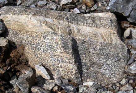
Figure 23 – Magmatic differentiation by crystal settling (view approximately 30×20 cm) (Boula, Orissa, India).
Concentrating now on the BIC, the portion where differentiation took place is termed the Critical Zone, and there, other types of crystal differentiation also occur, like the graded bedding seen in figure 25. I have never seen such perfection in sediments. In the present case, we have granular magnetite forming the base of the sequence, with feldspar crystals progressively increasing in quantity upwards, just like in sediments, with the heavier clasts reaching the bottom first. This impressive similarity between normal sedimentation and crystal settling, initially lead a school of geology in South Africa to believe that the BIC was a metamorphosed sedimentary sequence.
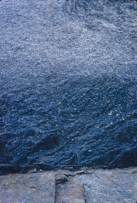
Figure 25 – Graded bedding by crystal settling (view approximately 1 m high) (Dwars River, South Africa).
This remarkable similarity is impressive, but it is fundamental to draw a distinction between the two. For that I use the sequence in the immediate vicinity of the platinum rich Merensky Reef, and I start by presenting the stratigraphic column of that sector, with its magnificently well defined and easily correlatable continuous stratigraphic sequence, including the consistent thicknesses of the various constituents, summarised in figure 25B.
From the top, and using the Impala Platinum Mines terminology, we have the hangingwall 1 (HW1) which is a norite, followed downwards by the Bastard Reef, constituted by a medium grained pyroxenite termed “bastard” because it contains no platinum. Below we have the middling 3 (M3) horizon of mottled anorthosite, followed by the M2 and M1 of spotted anorthosite and norite respectively. Below that we have the Merensky Reef which is presented in more detail further down.
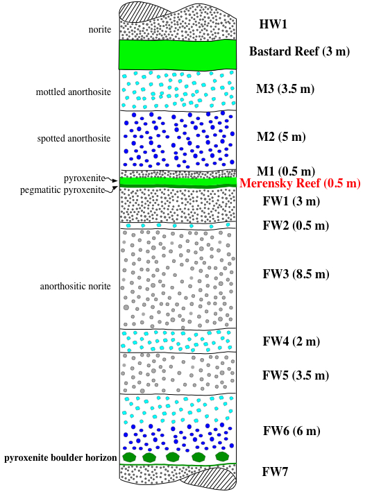
Figure 25B – The Bushveld Igneous Complex column of sediments in the vicinity of the undisturbed Merensky Reef (not to scale).
What is of interest now is the occurrence observed at the sector of the sequence where the locally termed “pyroxenite boulder horizon” occurs (fig. 25B) at the base of footwall 6 (FW6). The bottom contact of this member of the succession is a very well defined and continuous pyroxenite band above which there are scattered coarse grained pyroxenite nodules with an average diameter of 15 cm (fig. 25C).
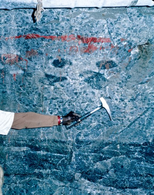
Figure 25C – Normal pyroxenite “boulder” horizon, about 50 cm above the distinct pyroxenite band (Bafokeng Mine, Rustemberg, South Africa).
However, as shown in figure 26, one of these “boulders”, considerably larger than normal, appears to have fallen through the semi fluid mush of the already settled pyroxenite band. Note that the “boulder” could not possibly be entirely solid, since it looks as if it is rather frayed at the edges. Photos 25C and 26 were taken along one of the mine adits, within 2 m of each other, and I think this example is rather useful in helping to understand the notion of a crystal settling environment.
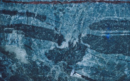
Figure 26 – Pyroxenite “boulder” falling through pyroxenite band (Bafokeng Mine, Rustemberg, South Africa).
2.3.2 “Pot Holes” Within the Merensky Reef
The platinum bearing Merensky Reef (MR) is generally a conformable horizon of the BIC and it is accepted that this band is the first layer after a new magma influx was injected into the settling chamber, raising its temperature and introducing platinum. That is why the MR has a pegmatitic texture, with a much coarser grain size than the layer immediately below, the approximately 3 m thick norite forming the footwall 1 (FW1). Further, the temperature rise also lead to the development of convection currents within the settling chamber, causing irregular whirls that in places disturbed the already settled crystals, developing what are locally termed “potholes”.
My first example of these potholes was chosen because it fits into the frame of a photograph. Even though it is in black and white, the added markings make it quite clear why these irregularities are known as potholes (fig. 26B). It also shows that the MR is formed by a pegmatitic pyroxenite with discontinuous thin chromite seams at the base as well as at the top, and this is covered by a medium grained pyroxenite. Further, at the centre of the photo, the MR pegmatite has “cut” through the FW2, a 50 cm thick anorthosite band, as well as about 30 cm into the FW3. Note though that, observation of the undisturbed sequence (fig. 25B), indicates that in fact, what figure 26B shows is only the bottom portion of a considerably larger pothole, since the FW1 is not at all present. That is, this pothole actually reaches a total depth of about 4 m, with only its central lowermost portion being visible in the photo.
This example is exceptional though, because predominantly the potholes are much larger, like the one shown in figure 27 where we see only a fraction of the pothole with, at the right hand side, a MR pegmatitic pyroxenite contacting practically vertically with a mottled anorthosite, interpreted as the filling of the centre of the pothole and shows a vague suggestion of horizontal layering, corresponding to a latter more quiet period of crystal settling.
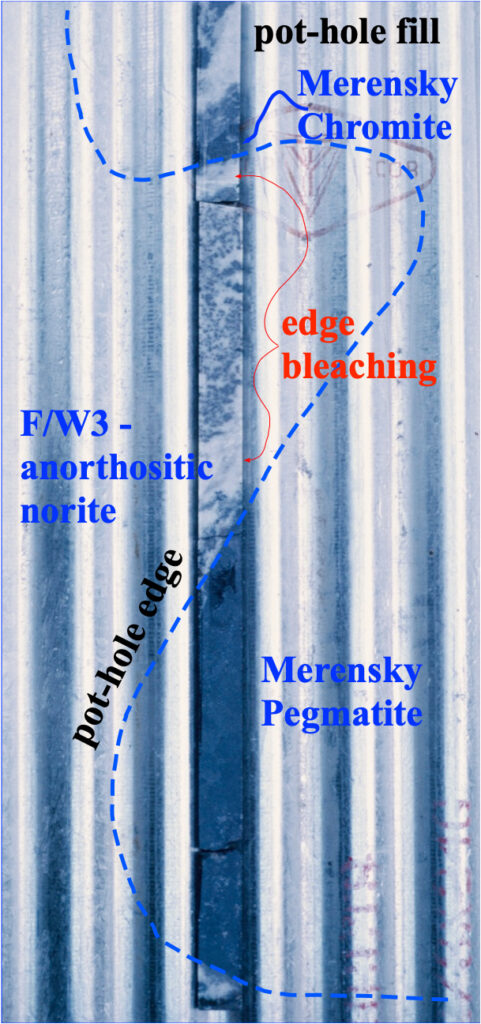
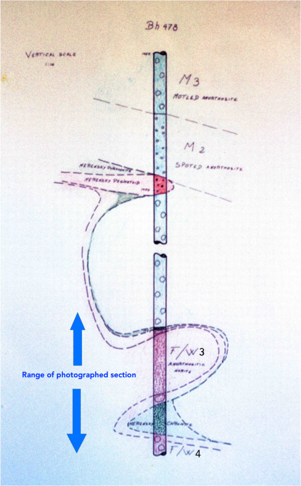
Finalising, figure 28 shows a diamond drill hole that intersected a large pothole and I think it adds to understanding the situation. The core is cut in half and laid on a corrugated iron tray.
Figure 28A is the interpretation section and it is more complete because of the camera’s dimensions limitation. The M3 and M2 horizons are present but, even though the M1 is not, we can accept that the MR (pink band), on the upper portion of the diagramme is reasonably close to its undisturbed position. Further down, the borehole intersected another mottled anorthosite, interpreted as the inner fill of the pothole. Next comes another MR horizon, this time consisting of a very thin chromite seam. Following, is a anorthositic norite (FW3) below which we have the final segment of MR at the base of the pothole, consisting of a rather thick chromite horizon very rich in platinum, underlain by a mottled anorthosite interpreted as representing FW4. In other words, this “pothole” has an approximate depth of just over 12 m.



Dear Author geologicalintroduction.baffl.co.uk !
I apologise, but, in my opinion, you commit an error. I can defend the position. Write to me in PM.
Dear Ilysergey,
I’m always open to corrections, please be more specific.
Regards,
Vitor Pacheco